Neelum Valley

Neelum Valley Overview

Azad Kashmir, abbreviated as PAK (literally “Free Kashmir”) is the southernmost and smaller of the two political entities that together form the Pakistan-controlled part of the former princely state of Jammu and Kashmir, which ceased to exist as a result of the 1st Kashmir War (1947) and the Indo-Pakistani war of 1948. The northernmost and larger of the two political entities is the Pakistan-controlled territory of Gilgit-Baltistan. Both PAK and Gilgit-Baltistan are self-governing political entities and do not constitute liberated parts of Pakistan under the constitution. However, for all practical purposes both PAK and Gilgit-Baltistan are treated as parts of Pakistan.

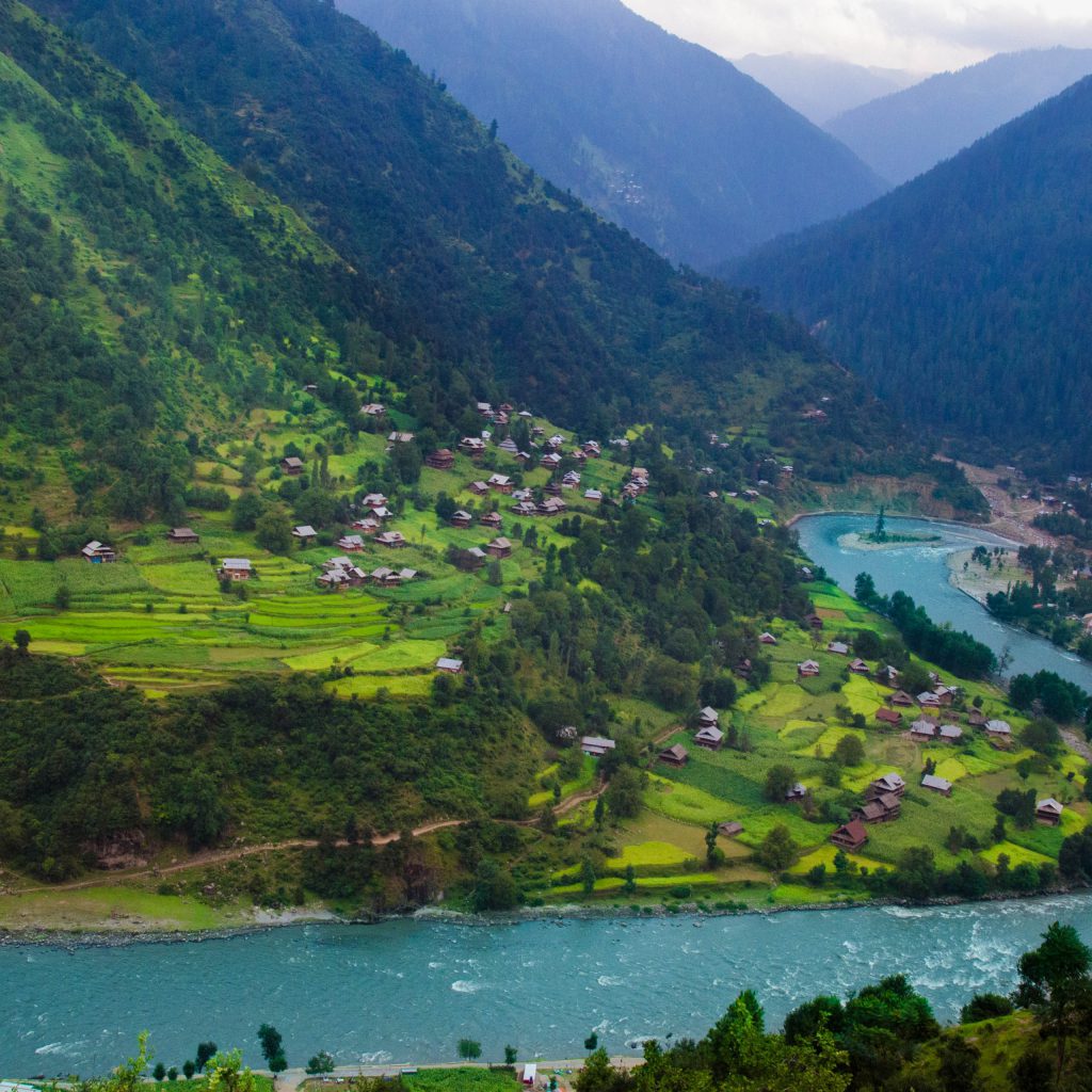
Neelum Valley is a picturesque valley located 240 km from Muzaffarabad. It runs parallel to the Kaghan Valley and is separated by snow-capped peaks. It offers a panoramic view of the hills on both sides of the river, lush green forests, magical streams, alpine lakes and attractive surroundings. It is also ideal for mountain hiking. A scenic road opens up this valley to tourists up to Kel, 155 kilometers from Muzaffarabad. There are daily buses on this route, and accommodation is also available at motor stations in tourist-attractive places.

The Neelum River was known as Kishan Ganga before Partition and was subsequently renamed after the village of Neelam. It flows down from the Gurez Valley in Jammu and Kashmir, India, roughly following a westerly and then a south-westerly course until it joins the Jhelum River at Muzaffarabad. The valley is a densely forested area with elevations ranging from 4,000 feet (1,200 m) to 7,500 feet (2,300 m), with mountain peaks on either side reaching 17,000 feet (5,200 m). Neelum Valley is 144 kilometers (89 mi) long.

Neelum district occupies most of the valley. The district is bounded on the south-west by Muzaffarabad district, which also includes the lower reaches of the valley; to the northwest beyond the mountains lies the Kaghan Valley in Mansehra District of Khyber Pakhtunkhwa; to the north and northeast are the districts of Diamer, Astore and Skardu in Gilgit-Baltistan. To the south and east are Kupwara and Bandipora districts in Indian Kashmir. The Line of Control runs through the valley – either over the mountains to the southeast or right along the river in places, with a few villages on the left bank falling on the Indian side of the border.
Neelum-1

Several languages ​​are spoken in the district. Predominant is Hindi. It is the language of wider communication in the area and is spoken at or near native level by almost all members of other language communities, many of whom are abandoning their language and moving to Hindi. This language is usually called Parmi (or Parimi, Pārim), a name which probably derives from the Kashmiri word apārim “from the other side”, which was a term used by the Kashmiris of the Kashmir Valley to refer to the highlanders who spoke this language.

See

Keran is a village and tourist resort in Neelam Valley, Azad Kashmir, Pakistan. It is located 93 kilometers (58 mi) from Muzaffarabad on the banks of the Neelam River at an altitude of 1,524 meters (5,000 ft). Neelam village is 2.5 km (1.6 mi) from here. An adjacent village on the other side of the Neelum River in Indian Kashmir is also known as Keran. Keran is accessible via the Neelam Valley Road and is located 93 km from Muzaffarabad.

Kutton is a village and tourist resort in the Neelam Valley of Pakistan-administered Azad Kashmir. It is located about 98 kilometers (61 mi) from Muzaffarabad (the capital of Azad Kashmir). Kutton is accessible via Neelam road from Muzaffarabad branch from Kundal Shahi.

Kel is about 19 km from Sharda. Kel is the land of the highest mountain, the 20,000 ft Sar Wali peak and a dozen others eg Naril Chita Par, Hariparbat, Shounter Pass, Lal Buti etc. There are about 200 lakes including big and small lakes in Kel. Area mostly covered by forest.

Wildlife includes brown bears and other wild animals. Tigers and snow leopard were seen there.

Taobat is a village in Athmuqam Tehsil in Neelam Valley, Azad Kashmir, Pakistan. It is located 200 kilometers (120 mi) from Muzaffarabad and 39 kilometers (24 mi) from Kel. It is the last station in Neelam Valley.

Sharda is a small town in Neelam district of Azad Kashmir, Pakistan. It is one of the two tehsils of Neelum district. It is situated on the banks of the Neelum River at an altitude of 1981 m, about 43 kilometers from Keran

Arang Kel is a village and tourist spot in the Neelam Valley of Azad Kashmir, Pakistan. It is located on a hill above Kel at an elevation of 8,379 feet (2,554 m). The village is accessible by a 2-kilometer (1.2 mi) trek from Kel. It can also be reached by a kilometer-long chairlift run by the Pakistan Army. To reach Kel, people usually enter the Neelam Valley from Muzaffarabad. After the ride from the chairlift, you have to take an approx. 1-hour hike to the village.

The City Maps