Hunza Valley

Hunza Overview

Hunza Valley is a mountainous region in Gilgit Baltistan, Pakistan. Hunza was formerly a princely state, bordering China to the northeast and the Pamirs to the northwest, which survived until 1974 when it was dissolved by Zulfikar Ali Bhutto. The state adjoined the Gilgit Agency to the south, and the former princely state of Nagar to the east. The capital of the state was the city of Baltit (also known as Karimabad) and its old settlement is Ganish Village.
The light-skinned, light-eyed Hunzakuts claim to be descendants of soldiers lost from Alexander’s army when he invaded India, although genetic studies have disproved this claim. The language, Burushaski, provides a mystery to linguists because it is not related to any other language.

The beauty of this mountain paradise is unsurpassed; from the soft blossoms of the apricot trees to the dark snowy rock monuments of Rakaposhi (7788m.), the recently climbed Ultra Peak (7388m.) with its vivid blue background high above and Bublimoting Peak.

Most of the people in Hunza are Islamic Muslims, followers of the Aga Khan.

Regions
Upper Hunza, Gojal – Upper Hunza (Gojal) is a beautiful valley where there are three different linguistic people, Burushaski speakers originated from central Hunza and migrated during the Ayashoo kingdom and Wakhi speakers oriented from Wakhan Corridor. 65% of the population includes Wakhi speakers and the remaining 34% are Burushaski speakers. The third dialect of Domki compared to 1% and their families found in Nazim abad and Shishkat village.
Hunza

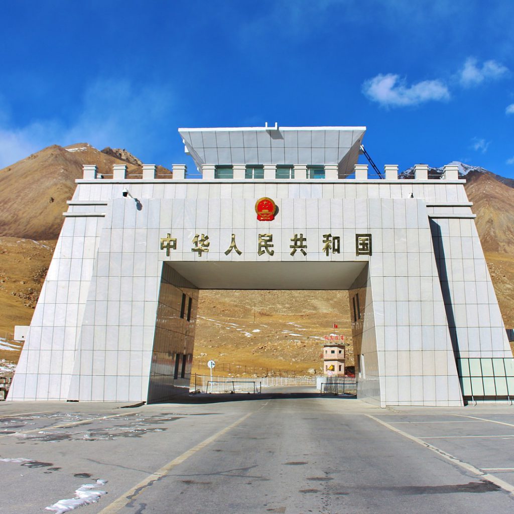
Upper Hunza starts from the village of Ayean Abad, today hit by a natural intervention (Atta Abad Disaster) and completely submerged in an artificial lake; Upper Hunza extends to Misgar, Shimshaal, and Chuporson (border areas). The village of Gulmit is the capital of the upper Hunza and Sost is an important village for commercial purposes because of the dry port of Sost. Upper Hunza is divided into four regions as Gojal1, 2, 3, 4 respectively. Gojal one composed of Ayean Abad, Shishkat, Gulmit, Passu, Hussaini. Gojal two consisting of Khyber, Galapan Murokhoon, Jamal Abad, Gircha, Nazimabad, Hussain Abad, Sost, Khudabad, and Misgar. Gojal 3 consisting of Shimshaal and finally Gojal 4 consisting of Khair Abad, Rashit, Kirming, Kill, Espangi, Shersaabz, and Zodokhon. The almighty KKH running from this Hunza region and empties into the neighboring country of China, in the area of ​​Khunjareb pass on the upper reaches of Hunza and from Chopurson wakhan corridor opens and this piece of land isolates this region from the former USSR.

Center Hunza – Center Hunza was an administrative region during the monarchy of the Ayashoo dynasty, the ruling family of Hunza for 980 years from 996-1974 and is still the main center of Hunza state. The center of Hunza starts at the beautiful village of Murtazaabad and ends at Attaabad. It consists of villages namely Murtazaabad, Hassanabad, Aliabad, Dorkhan, Shiras, Garelth, Hyderabad, Ganish, Karim Abad (Baltit), Mominabad, Altit, Ahmedabad, Gama Sareth and Attabad. This is the most populous sub-region of Hunza; Center Hunza is a two language oriented region 97% of the people speak Burushaski and the rest 3% speak Domki.

Lower Hunza – Lower Hunza is bordered by the Nagar Valley in the east and south. Lower Hunza starts from Khizirabad village and ends at Nasirabad. It consists of Khizirabad, Mayoon, Hussainabad, Khana Abad and Nasirabad. Nasirabad’s location on the KKH makes it the village center of Lower Hunza. This area basically consists of Shin-speaking people, mainly migrants from the nearby areas of Hunza, and many families belong to the families of the Hunza center. The Shina language is the dominant language, so people pronounce it as “Shinaki”. Culturally enriched and not much different from the culture of Middle Hunza. The culture of the area is based on social customs as well as religious customs at birth, marriage and death. KKH enters the region on the first bridge of Hunza, at Nasirabad (Hindi) from Nagar Valley. Above the text of Piyar Ali Sagi

The City Maps